


ARMSTRONG, Vanderburgh County, Indiana
About
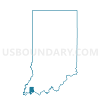
Outline

Summary
| Unique Area Identifier | 580953 |
| Name | ARMSTRONG |
| County | Vanderburgh County |
| State | Indiana |
| Area (square miles) | 29.52 |
| Land Area (square miles) | 29.48 |
| Water Area (square miles) | 0.04 |
| % of Land Area | 99.87 |
| % of Water Area | 0.13 |
| Latitude of the Internal Point | 38.13457060 |
| Longtitude of the Internal Point | -87.64675740 |
Maps


Graphs
Select a template below for downloading or customizing gragh for ARMSTRONG, Vanderburgh County, Indiana


Neighbors
Neighoring Voting District (by Name) Neighboring Voting District on the Map
- GERMAN PRECINCT 03, Vanderburgh County, IN
- GERMAN PRECINCT 04, Vanderburgh County, IN
- JOHNSON 03, Gibson County, IN
- ROBINSON 03, Posey County, IN
- SCOTT PRECINCT 03, Vanderburgh County, IN
- SCOTT PRECINCT 04, Vanderburgh County, IN
- SMITH EAST, Posey County, IN
Top 10 Neighboring County Subdivision (by Population) Neighboring County Subdivision on the Map
- Scott township, Vanderburgh County, IN (8,528)
- German township, Vanderburgh County, IN (7,441)
- Johnson township, Gibson County, IN (4,094)
- Robinson township, Posey County, IN (3,942)
- Armstrong township, Vanderburgh County, IN (1,599)
- Smith township, Posey County, IN (1,102)
Top 10 Neighboring Place (by Population) Neighboring Place on the Map
Top 10 Neighboring Unified School District (by Population) Neighboring Unified School District on the Map
- Evansville-Vanderburgh School Corporation, IN (179,703)
- South Gibson School Corporation, IN (12,317)
- North Posey County Schools Metropolitan School District, IN (8,669)
Top 10 Neighboring State Legislative District Lower Chamber (by Population) Neighboring State Legislative District Lower Chamber on the Map
- State House District 78, IN (77,639)
- State House District 75, IN (61,152)
- State House District 76, IN (59,647)
Top 10 Neighboring State Legislative District Upper Chamber (by Population) Neighboring State Legislative District Upper Chamber on the Map
- State Senate District 50, IN (139,117)
- State Senate District 48, IN (121,761)
- State Senate District 49, IN (113,960)
Top 10 Neighboring 111th Congressional District (by Population) Neighboring 111th Congressional District on the Map
Top 10 Neighboring Census Tract (by Population) Neighboring Census Tract on the Map
- Census Tract 107, Vanderburgh County, IN (8,528)
- Census Tract 502, Gibson County, IN (8,291)
- Census Tract 105, Vanderburgh County, IN (7,441)
- Census Tract 401, Posey County, IN (5,739)
- Census Tract 106, Vanderburgh County, IN (1,599)
Top 10 Neighboring 5-Digit ZIP Code Tabulation Area (by Population) Neighboring 5-Digit ZIP Code Tabulation Area on the Map
- 47720, IN (17,413)
- 47725, IN (15,851)
- 47639, IN (4,069)
- 47638, IN (3,577)
- 47633, IN (2,542)
- 47612, IN (861)